Tag: trail

New Frisbee Golf Course

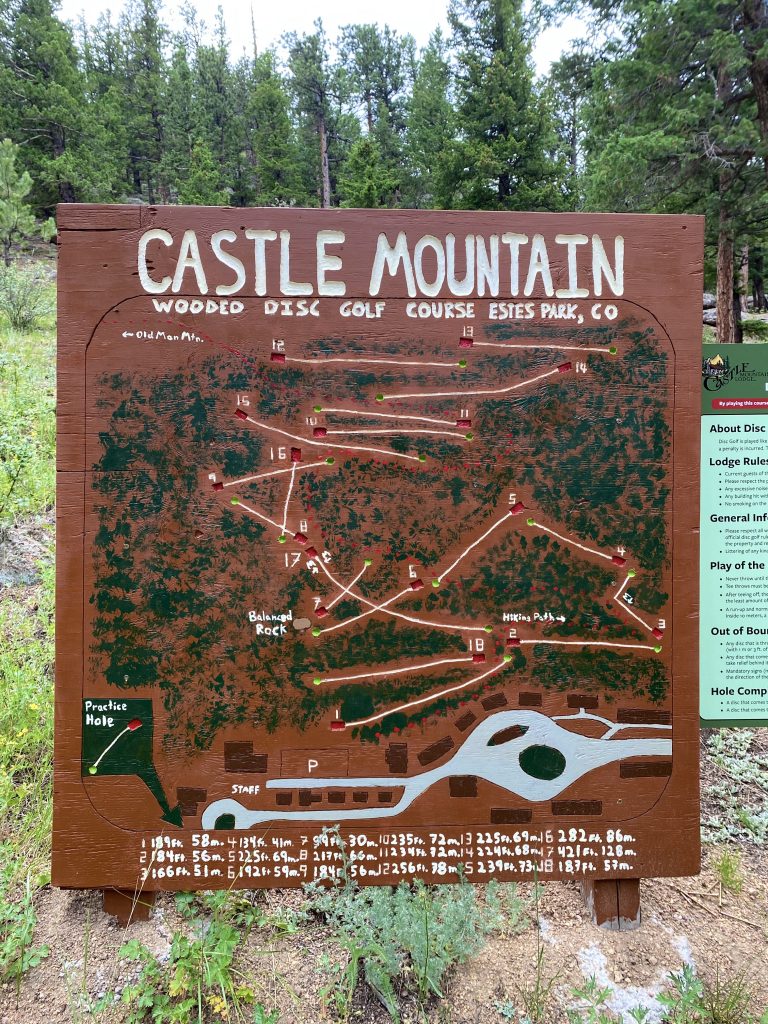
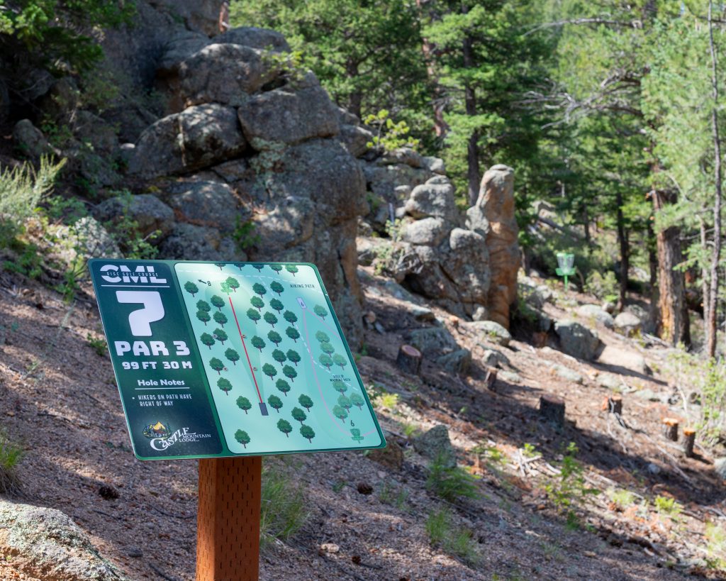
Frisbee golf is the latest international sports craze. Here at the lodges, we want to provide our guests with the best and most diverse experience possible, which is why we’re now putting in our very own Frisbee golf course on the mountain behind Castle Mountain Lodge. This project is projected to be completed by mid-late September, led by our very own Outdoor Project Manager and Frisbee Golf Enthusiast, Nathan Wood.

While we want everyone to have the best time possible on our course, we also want everyone to have the safest time possible and continue that established comfort we offer to all of our guests. In order to do so, we’ve established some extra rules of play which you can read up on below:

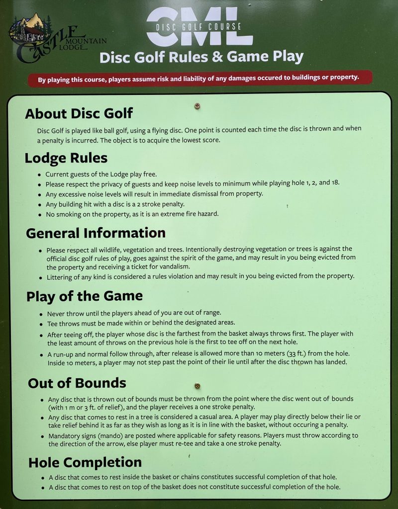
More information on the official rules of Frisbee Golf can be found here on the official PDGA rules page: https://www.pdga.com/rules

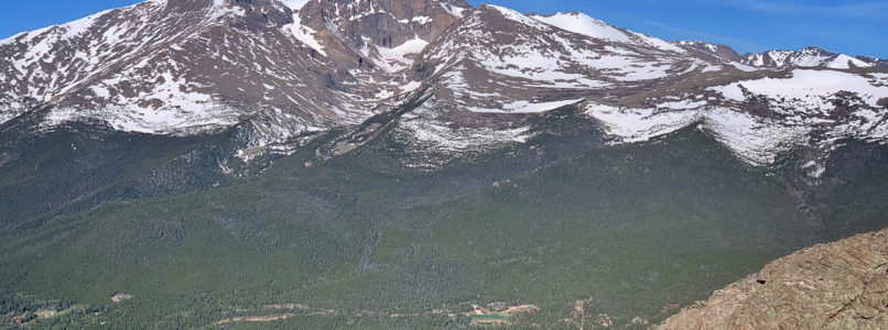
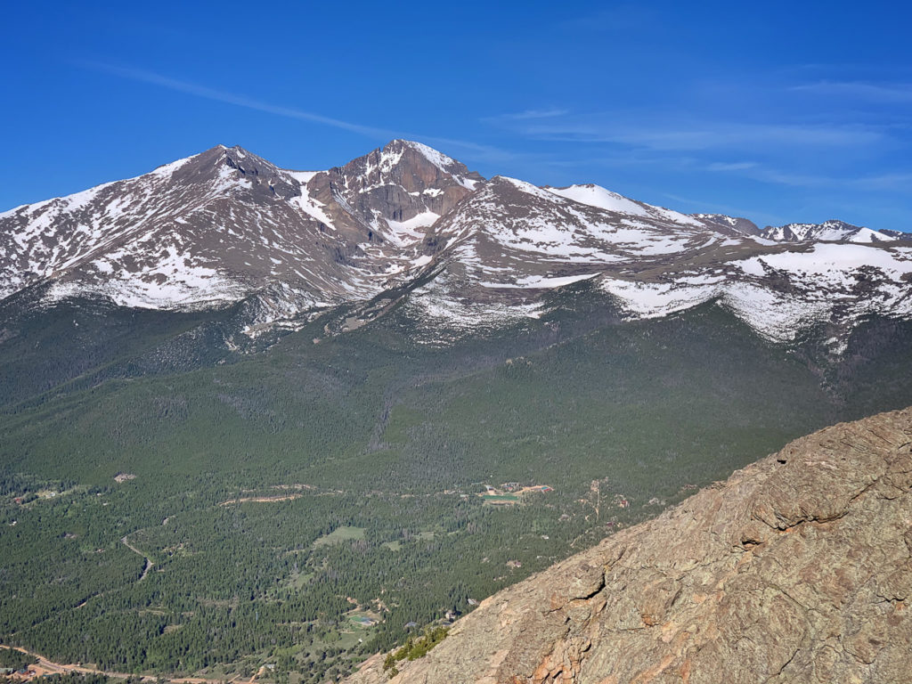
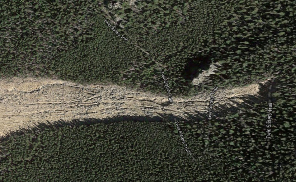
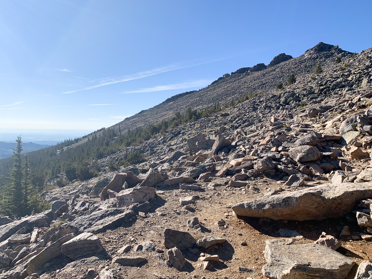
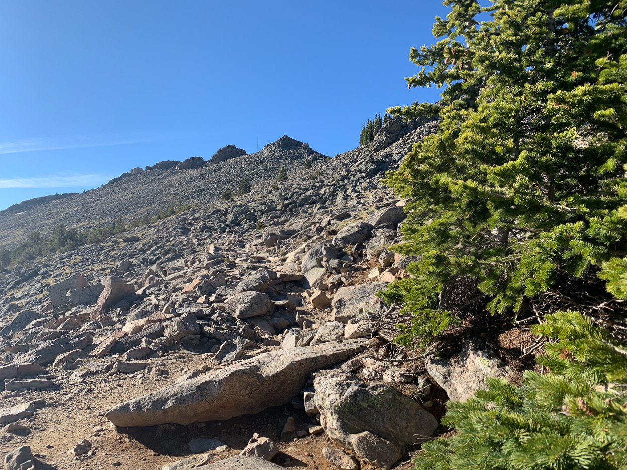
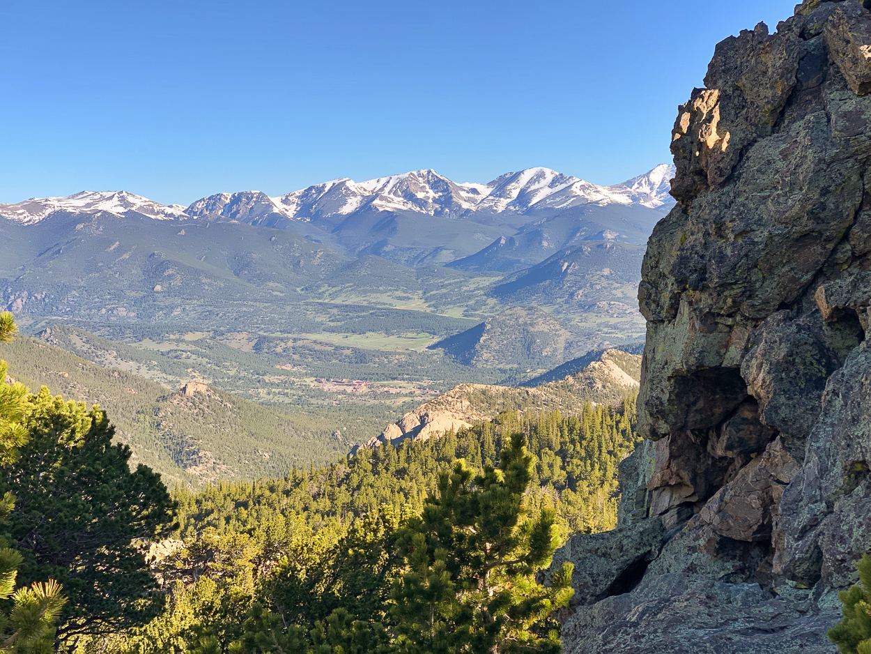
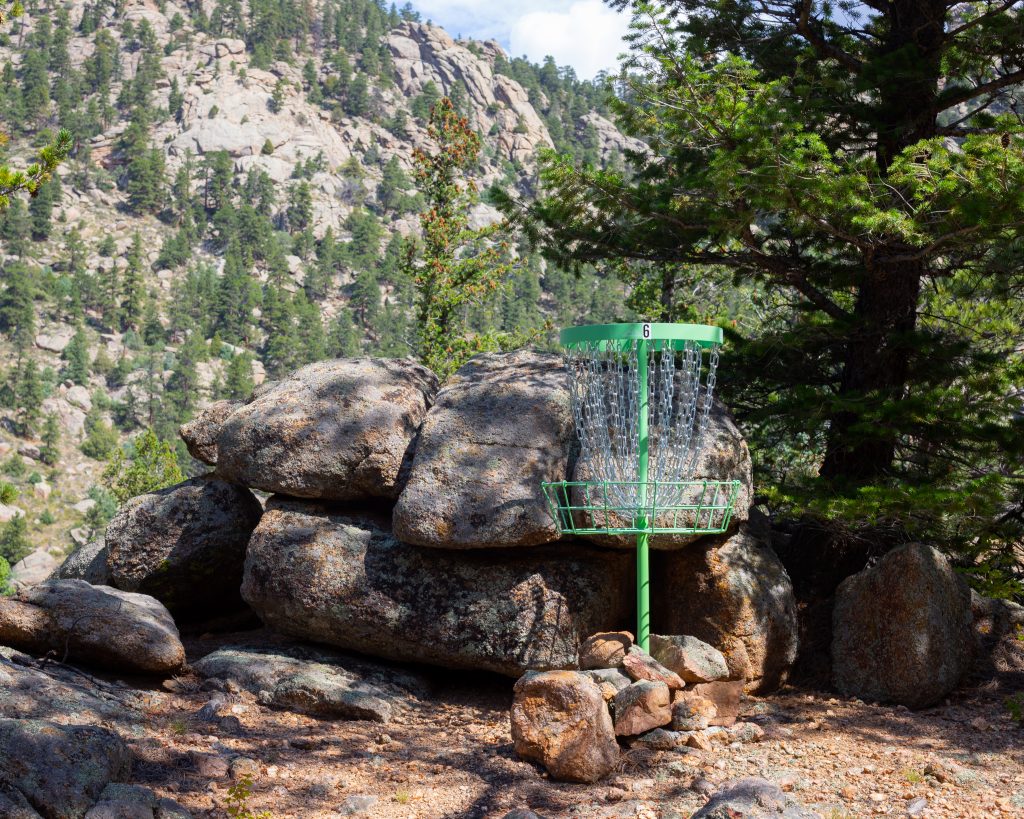
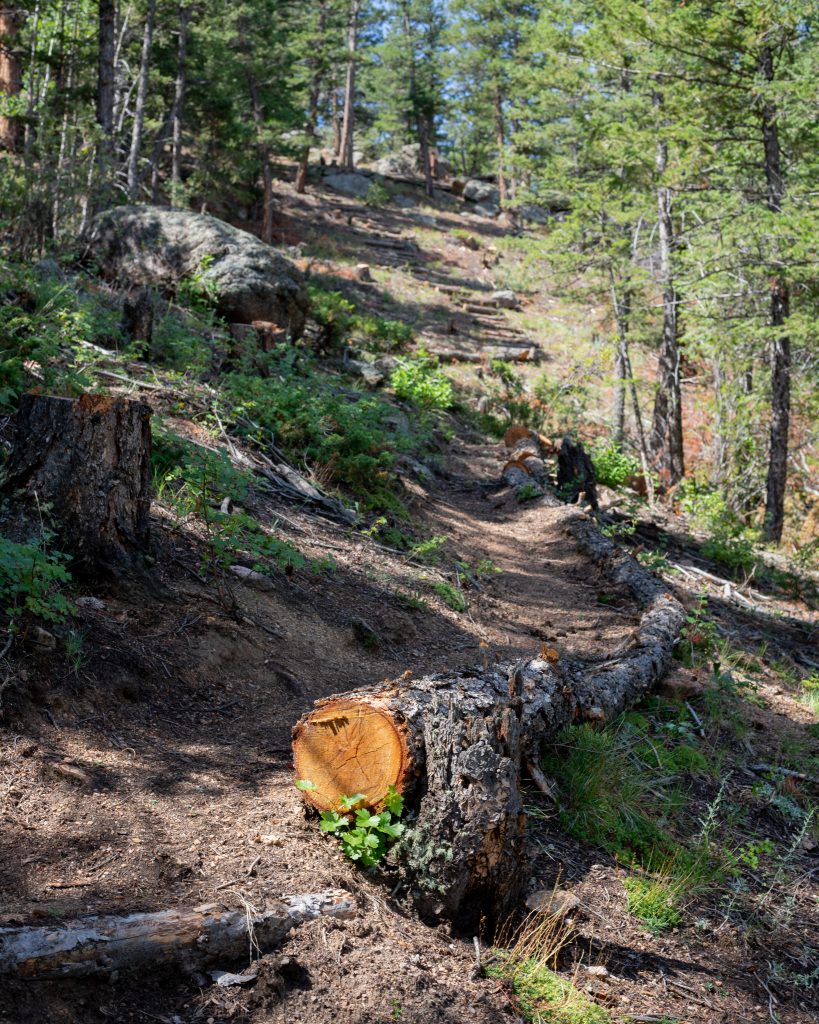
This 18 hole course stretches for 1 ½ – 2 miles along our Old Man Mountain trail back behind Castle Mountain Lodge. It hosts beautiful views all around, though it is not for the faint of heart. Being on the side of a mountain means there are steep slopes and rocky terrain throughout. The entire course has an established path throughout to help with the ascent and descent, but it is good to keep in mind that it is not a golf course. Hiking boots or rough wear shoes are suggested.

Guests staying at Castle Mountain Lodge are free to use the course between the hours of 8:00am and 9:00pm, or dark, whichever comes first! Sorry, but our frisbee golf course is only available for use by paying guests of Castle Mountain Lodge at this time. For more instructions and information, please visit or call our front desk between the hours of 8:00am and 9:00pm (970) 586-3664. We hope to see you out there!

Spring on Twin Sisters Mountain

Longs Peak from the summit of Twin Sisters
Longs Peak from the summit! What a view!

As the days get longer and the sun warms up our mountain landscape we all eagerly await the snow to disappear and the hiking trails to open up without the need for traction or floatation. One of the first high places to melt out is always the Twin Sisters trail that leads to the summit of Twin Sisters Mountain which stands at a respectable 11,427 feet, so this mountain always seems to get a lot of early season traffic.

The trail is easy to follow and very well maintained. Though the round trip is now only 6.6 miles, more on that later, it’s relatively steep with the total elevation gain hitting 2,363 feet.

Views from the trail
Views from the trail.

When I got up on the morning of June 10th, the thermometer ready a chilly 29 degrees F. I was a bit surprised, but the sun was out so I figured it would warm up quickly. I threw an extra layer on and drove up to the trail head and quickly hit the trail. At five to seven there were just three other cars at the trail head. This trail doesn’t ease you into anything and starts off at a pretty steep grade right away. For the most part, the trail is pretty uneventful, rising up through dense forest with the exception of a spot or two with some views over the Tahosa Valley below. At about one and a quarter mile up you reach the site of the huge landslide that happened during the flood event of September, 2013. It’s a pretty impressive sight and it wiped our quite a bit of the trail. Hikers made social trail of sorts in the following year and, only in the past year, the park service reestablished a trail through the area. It’s much shorter and much steeper than the old trail, hence the ‘now only 6.6 miles’ comment above. I think it shaved off a quarter of a mile, or a bit more, on the one-way distance.

Twin Sisters land slide
The 2013 landslide

Before too long you near tree line and wind through some stunning outcroppings with magnificent views to the north overlooking Estes Park and some of the northern mountains in the National Park (Mummy Range). Tree line ends abruptly and the views of the forthcoming summit push are always reason to stop and snap a quick photo.

This stretch always goes by quick, but seems to take longer than you’d expect when you first set eyes on it. But soon you’ll pop out on the little summit plateau with two main ‘summits’ before you. Most people head up the slightly closer, and lower, summit on your right while the true summit is the big block on your left. Pick your way across tundra (look for a variety of tundra flowers on this stretch) and a short, steep boulder field which will pop you out right on the summit. Turn to your right (west) and try not to let your jaw hit the rocky summit as the views are absurd!

Take your time up there, weather permitting, and make you way back down the way you came.

Hike Info:
Distance: 6.6 Miles
Elevation Gain: 2,363 Feet
Summit Elevation: 11,427 Feet
Trail Head Elevation: 9,206 Feet

Twin Sisters Elevation Profile

For more info, be sure to check out Erik Stensland’s hiking guide: Hiking Rocky Mountain National Park. The Essential Guide. (Purchase on Amazon)